Upper Clyde Valley (inc. Biggar & Lanark) map - OS Landranger 72 Format: Folded map Physical Size: 1000 x 890 mm (134 x 227 mm folded) Standard Publication Date: 24/02/2016 Weatherproof Publication Date: 24/02/2016
Newton Stewart & Kirkcudbright (inc. Gatehouse of Fleet) map - OS Landranger 83 Format: Folded map Physical Size: 1000 x 890 mm (134 x 227 mm folded) Standard Publication Date: 08/09/2021 Weatherproof Publication Date: 07/02/2022
Jura & Colonsay map - OS Landranger 61 Format: Folded map Physical Size: 1000 x 890 mm (134 x 227 mm folded) Standard Publication Date: 24/02/2016 Weatherproof Publication Date: 24/02/2016
The Second Lake District title has 28 circular walks - all tried and tested by seasoned walkers. The routes range from extended strolls to exhilarating hikes, meaning there is something for everyone. This guidebook includes several walks that are either...

Get unlimited access to detailed topographic mapping for the whole of Great Britain, Northern Ireland, USA, Australia and New Zealand with OS Maps Premium. OS Maps makes it easy to discover, plan and follow and explore routes in the great outdoors. Premium...

An authentic reproduction Ordnance Survey map of Romford from the Revised New Edition, 1896 to 1904. Printed flat, and delivered rolled in a tube. About our range of historical maps Our stunning Ordnance Survey Historical Maps make ideal gifts. Perfect...
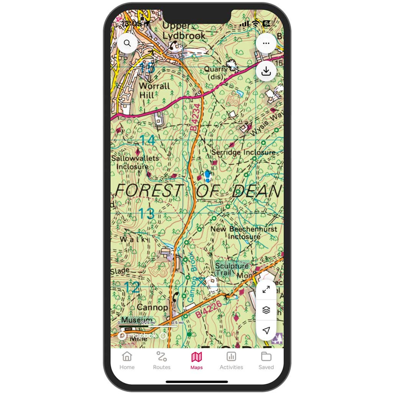
Get unlimited access to detailed topographic mapping for the whole of Great Britain, Northern Ireland, USA, Australia and New Zealand with OS Maps Premium. OS Maps makes it easy to discover, plan and follow and explore routes in the great outdoors. Premium...
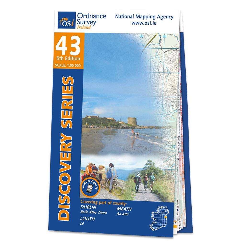
OSI Discovery Sheet No. 43 covers part of County Dublin, Meath and Louth at a 1:50 000 scale and is designed for all sorts of leisure activities including walking, cycling and tourism. Features shown on the Discovery series include walking trails, cycle...

OSI Discovery Sheet No. 33 covers part of County Leitrim, Longford, Sligo and Roscommon at a 1:50 000 scale, and is designed for all sorts of leisure activities including walking, cycling and tourism. Features shown on the Discovery series include walking...

Improve your walking safety and make more of your time outdoors with this concise guidebook for walkers, full of step-by-step guides with clear illustrations. Navigation Skills for Walkers will help you grow your skills in map reading, using a compass,...
|
|